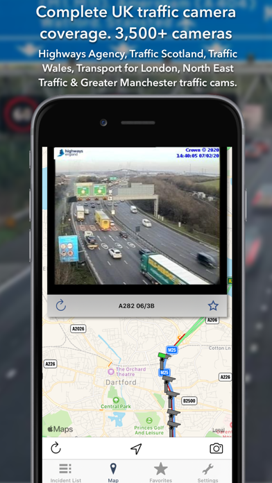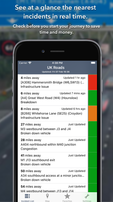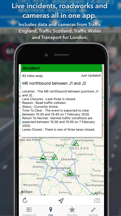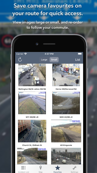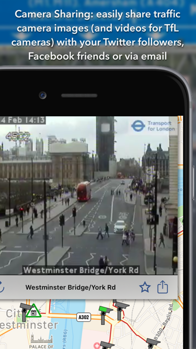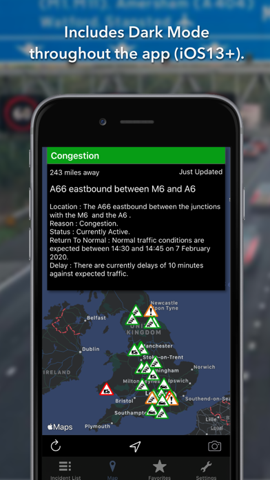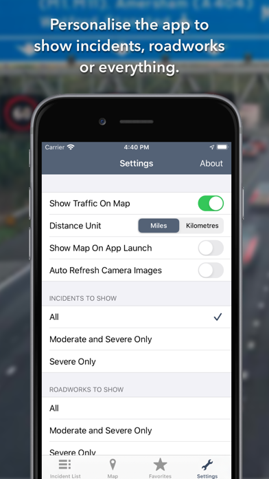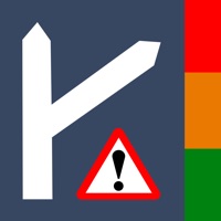
The ONLY app to show live traffic incidents, roadworks and 4,700+ cameras covering England, Scotland and Wales. The app was updated during January 2023. KEY FEATURES Live traffic incidents, roadworks and traffic cams covering: - England: Traffic England for all motorways and main trunk roads: 2,000+ cameras - Scotland: Traffic Scotland: 304 cameras - Wales: Traffic Wales: 250 cameras - London: TfL: 911 VIDEO cameras - Manchester: 63 cameras - Tyne & Wear: 261 cameras - Essex: 35 cameras - Tamar Crossing: 2 cameras - Today screen widget to show at a glance the nearest current traffic incidents - Optimised for all iPhone and iPad models. - Dark Mode throughout the app (iOS13+). - Sharing: you can easily share traffic camera images (and videos for TfL cameras) with your Twitter followers, Facebook friends or via email etc. LIST VIEW - Shows current incidents in order of distance from your current location (closest incidents are shown first). - Each incident is colour-coded to indicate the severity of the delay. - You can quickly see the distance the incident is from you, the road name, the type of incident and when the incident info was updated. - The detail view for each incident shows the description of the incident together with a map showing the exact location of the incident. MAP VIEW - Shows current incidents and traffic cams. - Each incident is colour coded as well as being represented by an icon showing the incident type. - Clicking on an incident displays more detail right there on the map. - The map view can also show live traffic camera images. TRAFFIC CAMS - Toggle show/hide the cameras on the map. - Touch a camera icon on the map to view a live camera image. TRAFFIC CAM FAVOURITES - Save your favourite cameras for quick access to see how clear/congested your usual routes are. TODAY WIDGET - Shows at a glance the nearest current traffic incidents without launching the app. PERSONALISE - Toggle traffic information on the map. - Toggle auto refresh of camera images (will refresh every 10 seconds). - Toggle always show map on app launch. - You can configure which incidents are displayed according to the severity of the delay caused. - Miles or Kilometres setting. ICONS AND COLOUR CODING - The icons on the map show the type of incident so you can see at a glance both the incident type and severity (indicated by the colour of the icon). The incident icons currently available are: - Accident: ambulance icon - Congestion: standard congestion sign (3 cars) icon - Breakdown: car with bonnet raised icon - Signal Failure: traffic signal icon - Event (such as football match, concert): a calendar event icon - Snow or flooding: the appropriate icon - Other/Hazard/Incident: standard hazard (exclamation mark) icon Incidents are colour coded accruing to severity: - Red: severe; delays of one hour or more, or road/exit closed - Orange: medium; delays 15 minutes or more - Green: minor; delays less than 15 minutes CONTACT - Email me for feature requests/bug reports etc. I would love to hear from you! - Follow @ukroadsapp on Twitter for latest news on the app.