GPX viewer

GPX viewer

von Jonathan Gander

  • Kategorie: Navigation
  • Veröffentlichung: 2020-05-06
  • Aktuelle Version: 1.3.10
  • Alterseinstufung: 4+
  • Dateigröße: 34.45 MB
  • Entwickler: Jonathan Gander
  • Kompatibilität: Lauffähig ab iOS 13.0 oder neuer.
Score: 4.72499
4.72499
von 40 Bewertungen

Beschreibung

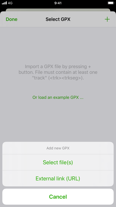
Import your routes in GPX format (tracks or routes) into the application. Display them on different preset maps (plan, satellite, OpenStreetMap, OpenTopoMap, Swisstopo, IGN) or on your own custom maps. Display an elevation graph to evaluate their difficulty. And check out all of their information. Follow your position along the route during your ride. You can also display points of interest from GPX. All what you need to go hiking and follow your route. All for free and without ads. The only in-app purchases are tips for few other features, take a look. Features details: - Import of GPX files via file or web link - Management of imported GPX (library) - Display GPX track on the map (track and route) - Several base maps: map, hybrid, satellite 3D, OpenStreetMap, OpenTopoMap, Swisstopo - Possibility to set your own custom maps from a library or manually - Possibility to download maps for offline use - Displayed on the map: current position, start and end of the route, points of interest along the route, scale, route direction - Choice of color and size of the route - Locking of screen standby to better follow the route - Map cache system - Display of GPX details: name, description, longitudinal profile, elevation differences, distance, image gallery, link, points of interest - Display details of a point of interest: name, description, image gallery, links - Access to the route via Maps, Google Maps or Waze - Sharing a GPX - GPX editor - Speedometer Note: If the application cannot open a GPX file, contact me by sending me the file.

Screenshots

Reviews

  • Perfekte App

    5
    von ktmchris950
    Endlich eine App die genau macht was sie soll ,GPX Daten sichtbar auf einer Karte anzeigen . Nicht mehr und nicht weniger .Und das ohne Registrierung ,Bankverbindung ,Geburtsurkunde und Schuhgröße…. Top App.
  • Klasse — Pro lohnt sich

    5
    von Patrick Petry
    Ich habe die App empfohlen bekommen, nachdem ich zwar viel über Komoot mache, dort jedoch immer einige Einschränkungen sind, z.B. während einer Aufzeichnung auf eine Tour zuzugreifen. Die App begrenzt sich auf die wesentlichen Funktionen: GPX-File importieren, ggf. editieren, Maps für offline Nutzung laden, navigieren. Nützlich auch, dass man die Anreise zum Startpunkt der Tour zur Navigation (Google Maps, Waze) direkt aufrufen kann. Man merkt, dass der Entwickler seine App selbst benutzt. Zusammen mit GeotagPhotos2, die ich zum Aufzeichnen der GPX-Files auch für meine Fotos verwende, ist GPXViewer die perfekte Ergänzung. Die Zusatzfunktionen der Pro-Version (mehrere GPX-Files, editieren u.a.) sind es wert.
  • Sprachauswahl

    2
    von Nepper Schlepper Bauernfängee
    Wo kann man die Sprache auswählen?
  • Tolle App für Wanderungen & Co!

    5
    von MaSa061089
    Eine absolut tolle, gelungene & intuitive App! Einzig eine Frage ist bei mir noch offen (freue mich über eine Antwort 😉): Kann die App auf dem Smartphone auch OHNE jegliche SIM-Karte genutzt werden?
  • pro version required for offline maps

    1
    von gamer 123345688
    scrolling has bugs pro version de-facto required
  • Sehr empfehlenswert!!!

    5
    von freakyline
    Macht genau das, was es soll. Absolut übersichtlich und wird weiterentwickelt - das sollte einem die Pro-Version wert sein. Weiter so!!!
  • Great App

    5
    von Stephan E
    Nothing to say but thank you. Great App. 👍 Enjoy the Burger 😉 Additionally GPX Tracking would be perfect to creat my own trails using your App. Because I really like your App.
  • Perfect

    5
    von MisterWasGehtSieDasAn?
    I‘m using this App for Mountainbiking. There‘s no better App for GPX-Trail-Files. Keep it on this Level
  • Very good

    4
    von philmcole
    This app is very good. It has a minimal clean UI using native UI controls and is smooth. I tried using it to plan a European long distance route and I have some suggestions how it could be made even better. Feature suggestions: - Download whole regions for offline use. The download region around route is great already, but sometimes I want to deviate from my path on the go and still have a map. Currently I need to use the Automatic cache feature and pan and zoom around manually. Downloading a whole rectangular region similar to how Google Maps allows it would be very helpful. I imagine a rectangular selection with a scale showing the size in kilometers. - The Maximum Zoom Level setting for the Offline map download is not really helpful to the normal user. The user doesn’t know what a zoom level of “7” means. Maybe it could be expressed in kilometers? Maybe it could even reuse the same rectangular selection from the Offline regions feature mentioned above. - Ability to toggle hide and show of a loaded route. If the route coincides with paths or streets on the map, they can’t be read anymore because the route is drawn over it. Path names, street names might be important for navigation. Bugs: - OSM and OTM scale is too small. The labels and features are so small on a phone screen that they’re almost impossible to read. Zooming in doesn’t help because they stay small. - Loading big GPX routes is very slow. The UI almost freezes to slow motion and drains battery. I suspect it draws the whole route, even though most of it is off-screen and invisible. Maybe it could lazy load only the parts that are in the currently visible region.
  • Top GPX Tool

    5
    von Dispatcher71
    Sehr gutes Tool um Tracks einfach und übersichtlich darzustellen. Ohne Werbung und für eine kleine Spende gibt’s den vollen Nutzungsumfang 👍🏼

keyboard_arrow_up